May 11, 2022
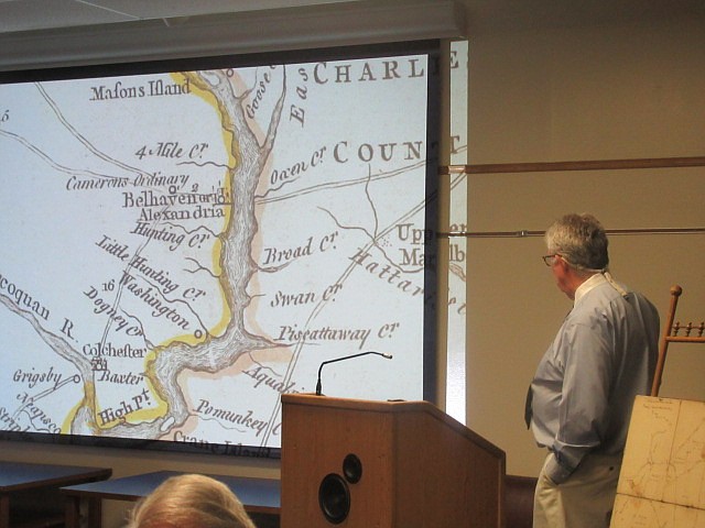
Green discussed a 1753 map of Virginia by Joshua Fry and Peter Jefferson, Thomas Jefferson’s father. It shows the Potomac River north of today’s Prince William County to today’s Theodore Roosevelt Island (Mason’s Island) and Maryland creeks.
Stories this photo appears in:
Maps Tell Stories of the Past
People have been making maps of the Mount Vernon area for four centuries and maps convey more than pictures,” Kevin Green began as he...
Comments
Use the comment form below to begin a discussion about this content.
Sign in to comment
Or login with:
OpenID